Outdoor / Sports Tech
MoonGuide
Hunting Intelligence Platform Powered by Lunar Data
QStart Labs built the mobile applications and web backend for MoonGuide, a hunting platform that combines moon phase science, weather analytics, and location intelligence to help deer hunters maximize their success in the field.
About MoonGuide
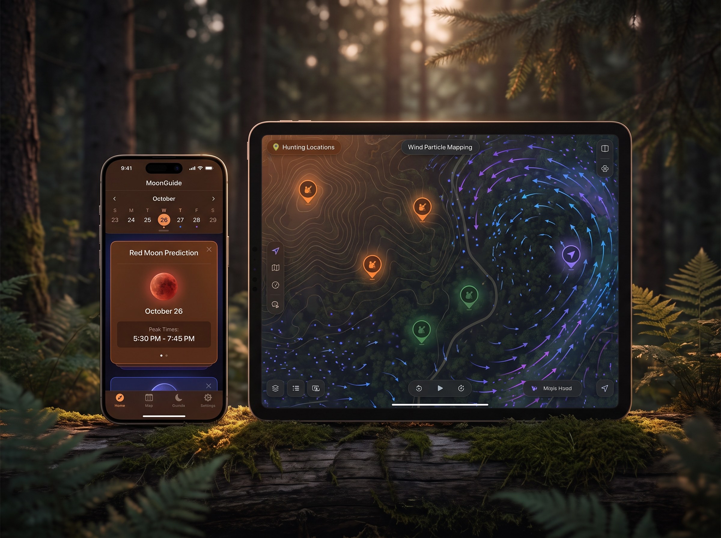
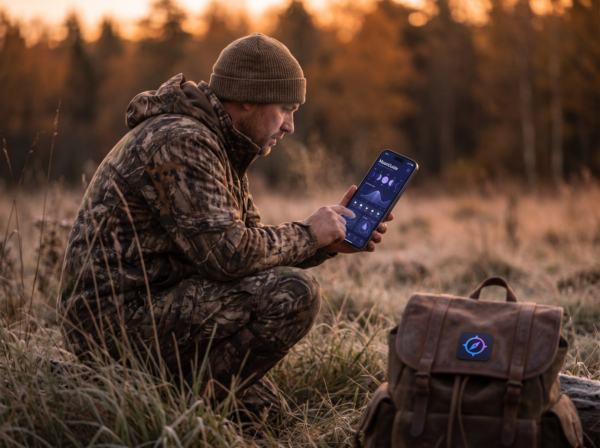
MoonGuide is a mobile hunting application designed to optimize deer hunting success by combining lunar data with location intelligence and weather analytics. The platform's signature "Red Moon" predictions help hunters identify the best days and times for deer activity.
Beyond moon phase analysis, MoonGuide offers wind particle mapping for scent tracking, a nationwide land owner database, hunting journals for tracking observations, and a community forum called "The Rub" where hunters share experiences and tips.
Target Audience
The Challenge
Building a hunting intelligence platform required solving unique technical challenges.
Complex Astronomical Calculations
The app needed to calculate precise moon rise/set times, transit positions, and illumination percentages for any location, factoring in timezone and seasonal variations.
Rich Mapping Experience
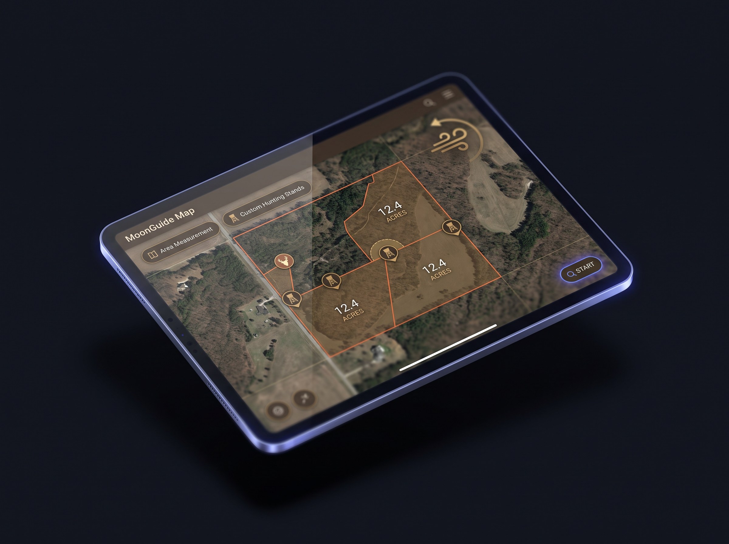
Hunters needed interactive maps with property boundaries, custom markers, measurement tools, and wind visualization — all working offline in remote areas.
Multi-Source Weather Integration
Accurate hyper-local weather forecasts required integrating multiple weather APIs and presenting data in a hunter-friendly format.
Offline-First Mobile Experience
Hunters often lack cell service in the field, requiring robust offline capabilities for moon data, maps, and journal entries.
Our Solution
We delivered a comprehensive mobile and backend solution optimized for hunters.
React Native Mobile Applications
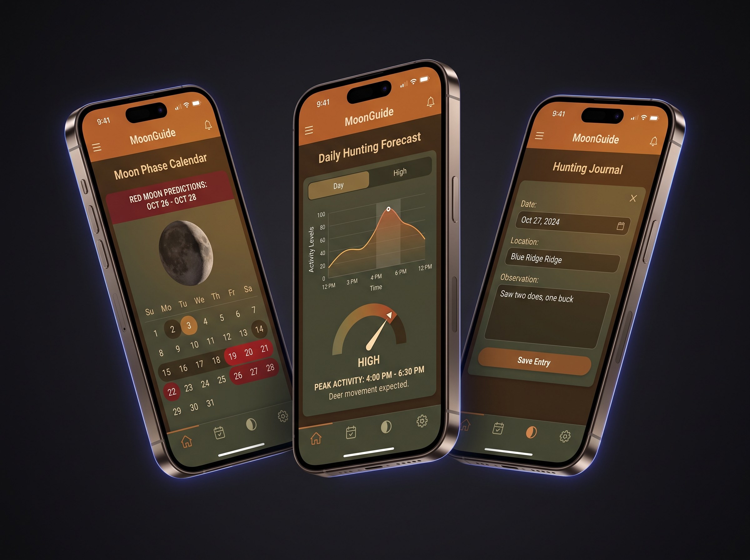
We built cross-platform iOS and Android apps using React Native, delivering a native experience with shared business logic for moon calculations and hunting predictions.
- React Native 0.78 with React 19 for modern performance
- Redux state management with offline persistence
- SunCalc and Solunar libraries for astronomical calculations
- SQLite local database for offline zipcode lookups
- Firebase integration for analytics and push notifications
Interactive Mapping & Location Intelligence
Implemented rich mapping features using Mapbox GL, giving hunters powerful tools to scout and plan their hunts digitally.
- Mapbox GL integration with custom styling
- Turf.js for geospatial calculations and area measurements
- LandGrid API for property boundary data
- Wind particle mapping visualization
- Custom markers, lines, and shape drawing tools
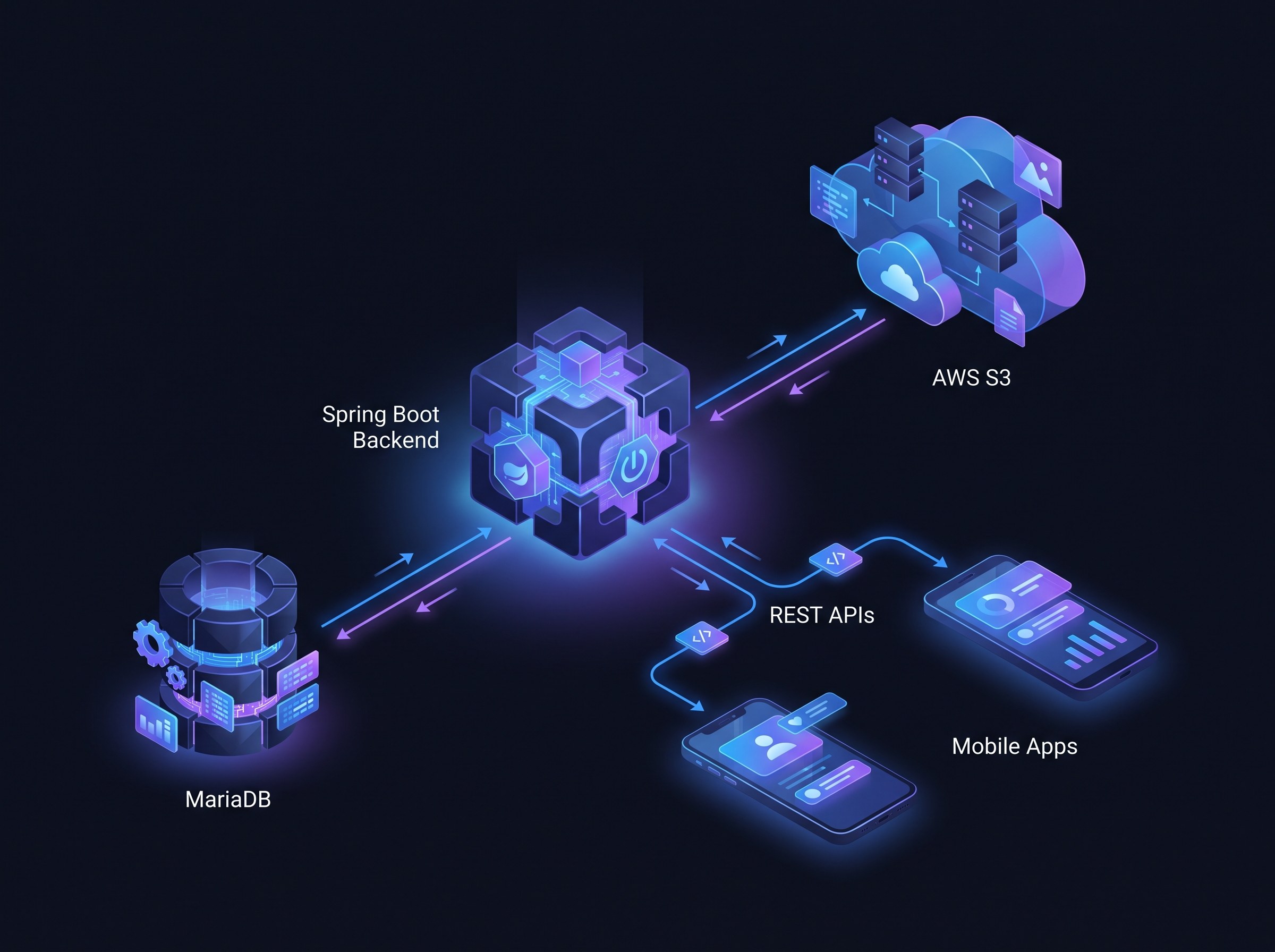
Spring Boot Backend Platform
Built a robust Java backend to handle user accounts, subscriptions, content management, and synchronization between devices.
- Spring Boot 3.4 with Java 21
- MariaDB database with Hibernate ORM
- JWT authentication with 1-year token expiration
- Apple App Store and Google Play subscription validation
- RESTful APIs for mobile app synchronization
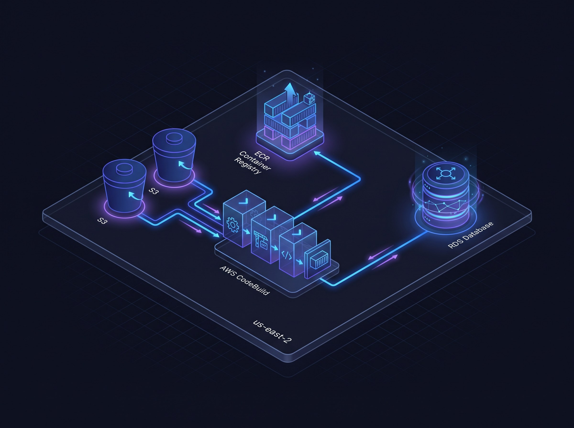
AWS Cloud Infrastructure
Deployed the platform on AWS with automated CI/CD pipelines, ensuring reliable performance during peak hunting seasons.
- AWS S3 for media and image storage
- Docker containerization for consistent deployments
- AWS CodeBuild for automated CI/CD pipelines
- AWS CodeArtifact for dependency management
- CloudWatch logging and monitoring
Platform Capabilities
MoonGuide offers a comprehensive suite of features for serious deer hunters.
Red Moon Predictions
Proprietary algorithm predicting optimal deer activity based on moon transit times relative to sunset.
Wind Particle Mapping
Visualize scent travel and airflow patterns to optimize stand placement.
Hunting Journal
Log sightings, weather conditions, and photos to identify behavioral patterns over time.
The Rub Community
Social forum for hunters to share experiences, tips, and hunting predictions.
Land Owner Database
Nationwide parcel ownership data to research properties and contact landowners.
Weather Forecasting
Hyper-localized 10-day forecasts with radar visualization for hunt planning.
Technology Stack
We selected technologies optimized for mobile performance and offline reliability.
The Results
MoonGuide helps thousands of hunters plan more successful hunts.
Key Takeaways
Domain Expertise Matters
Understanding the hunting community's needs was essential to building features that actually help hunters succeed in the field.
Offline-First Architecture
Designing for areas with no cell service required careful planning around data caching, local calculations, and sync strategies.
Complex Calculations, Simple UX
Translating astronomical algorithms into intuitive "Red Moon" predictions made advanced science accessible to everyday hunters.
Building a Mobile App with Complex Data?
We specialize in apps that combine rich data, offline capabilities, and intuitive UX. Let's discuss your project.
Prefer to reach out directly?
Rather skip the form? Grab a free 30-minute discovery call and we'll talk it through together.
We reply within one business day.